 Azərbaycanca (AZ)
 Deutsch (DE)
 English (US)
 Қазақша (KZ)
 Lietuva (LT)
 සිංහල (LK)
 Türkçe (TR)
 O'zbekcha (UZ)
 中國人 (CN)
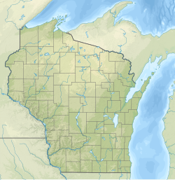
Timms Hill or Timm's Hill is the highest natural point in the U.S. state of Wisconsin and is located in north-central Wisconsin in Timms Hill County Park in the Town of Hill in Price County. After being surveyed by Quentin Stevens of Ogema Telephone Co in 1962, Timms Hill was discovered to have an elevation of 1,951.5 ft (595 m). It is less than 1 mile (1.6 km) south of Highway 86, about midway between Ogema and Spirit and about 23 miles (37 km) west of Tomahawk.
| Timms Hill | |
|---|---|
 Timms Hill, Wisconsin, July 2014. | |
| Highest point | |
| Elevation | 1,951.5 ft (594.8 m) |
| Prominence | 425 ft (130 m) |
| Listing | U.S. state high point 39th |
| Coordinates | 45°27′03″N 90°11′43″W / 45.450884317°N 90.195397889°W |
| Geography | |
 Timms Hill Wisconsin | |
| Location | Price County, Wisconsin, US |
| Topo map | USGS Timms Hill |
| Climbing | |
| Easiest route | Hike |
Description
Timms Hill is located in Timms Hill County Park. A public lookout tower is atop the hill. Visible to the southeast is Rib Mountain (elev. 1,924 ft, 586 m), 44 miles (71 km) away by line of sight. The 10-mile (16 km) Timms Hill Trail connects to the Ice Age Trail, a National Scenic Trail stretching 1,200 miles (1,900 km) across glacial terrain in Wisconsin.
Climate
| Climate data for Timms Hill 45.4497 N, 90.1974 W, Elevation: 1,837 ft (560 m) (1991–2020 normals) | |||||||||||||
|---|---|---|---|---|---|---|---|---|---|---|---|---|---|
| Month | Jan | Feb | Mar | Apr | May | Jun | Jul | Aug | Sep | Oct | Nov | Dec | Year |
| Mean daily maximum °F (°C) | 19.6 (−6.9) | 24.6 (−4.1) | 36.2 (2.3) | 49.5 (9.7) | 63.3 (17.4) | 72.3 (22.4) | 76.6 (24.8) | 74.3 (23.5) | 66.5 (19.2) | 52.2 (11.2) | 37.1 (2.8) | 24.7 (−4.1) | 49.7 (9.9) |
| Daily mean °F (°C) | 10.3 (−12.1) | 13.5 (−10.3) | 24.9 (−3.9) | 38.4 (3.6) | 52.0 (11.1) | 61.5 (16.4) | 65.9 (18.8) | 63.7 (17.6) | 56.1 (13.4) | 42.7 (5.9) | 29.5 (−1.4) | 16.8 (−8.4) | 39.6 (4.2) |
| Mean daily minimum °F (°C) | 1.0 (−17.2) | 2.5 (−16.4) | 13.7 (−10.2) | 27.3 (−2.6) | 40.7 (4.8) | 50.7 (10.4) | 55.2 (12.9) | 53.0 (11.7) | 45.8 (7.7) | 33.3 (0.7) | 21.8 (−5.7) | 8.9 (−12.8) | 29.5 (−1.4) |
| Average precipitation inches (mm) | 1.09 (28) | 1.03 (26) | 1.58 (40) | 2.77 (70) | 3.64 (92) | 4.48 (114) | 3.88 (99) | 3.90 (99) | 3.69 (94) | 3.18 (81) | 1.85 (47) | 1.41 (36) | 32.5 (826) |
| Source: PRISM Climate Group | |||||||||||||
See also
- List of U.S. states by elevation
wikipedia, wiki, encyclopedia, book, article, read, free download, Information about timms hill. What is timms hill? What does timms hill mean?